

It was a nice adventure just getting to the "Fish Lake Trailhead" - start out on I-90 West:


(Although I-90 seems to be the "highway of choice" for this trip, don't try this on the Mass Pike!)
After 54 miles on the highway, you have another 43 miles on dirt roads, in various states of repair (or disrepair):

Of course there are grand vistas:

Watch out - there were 4 deer at various places on this road, coming in over Long Creek and Rawhide Creek.
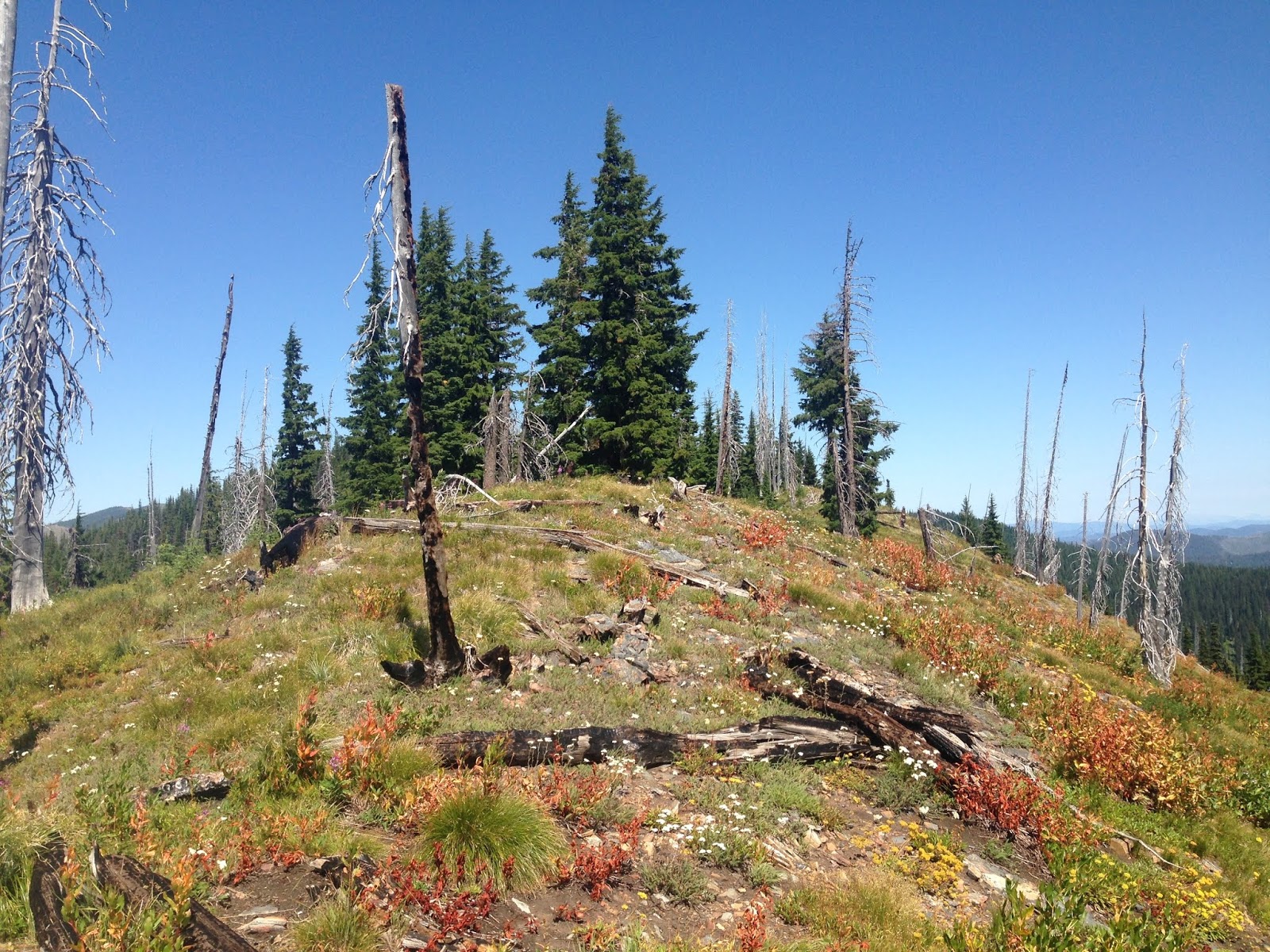
Eventually you wind up at the road up to Fish Lake (Forest Road 295):

A bad road going up next to a beautiful creek ("Lake Creek"):

I'm glad I have my Crosstrek.
I parked at the Fish Lake Trailhead:

and started my hike a little before 10.
Nice "old road" for the trail:

You cross a couple of streams:

I saw a deer bounding through the forest.
At a hair-pin turn in the "road" is Trail # 419 A, which I did not take on my way up, but I did on my way back down:

The wildflowers are still out:

I reached beautiful Fish Lake about 12:30


There are BAD Trail markings/NO trail markings (this is the intersection with Stateline Trail (Trail 738) northbound, but there is NOTHING marking it!):

Therefore I wound up going DOWN Stateline Trail (Trail 738) southbound, instead of UP Stateline Trail (Trail 738) northbound [the "Steep Lakes Loop"]:


I didn't like that I was hiking south, but I did like that I was "hiking up", so I kept going. NOTE: I did not purchase a map for this area because:
- I thought that their ("Hiking Idaho" by Falcon) 3-page description of the hike was fine to keep me on-track, and
- I thought the trails would be as appropriately-signed as they have been in all the other areas I have hiked (New England, the Wind River Range, the Beartooth Mountains, etc).
I was wrong, and if I had had "the correct map" maybe that would have enabled me to pick the correct trail cutoff (although I have to admit that I'm not fond of the idea of going down unmarked trails).
I eventually wound up southeast of Fish Lake, looking WAY DOWN:


Up on this ridgeline, I knew I didn't want to continue straight south:

so I did a hairpin turn and followed a trail that went back north along the ridgeline. When I broke out of the forest, I was going north, but on the east side of the ridgeline:

It was 1:20 in the afternoon, on a beautiful sunny day. I wasn't worried because I knew exactly how to get back to Fish Lake. Continuing on this trail, I saw a beautiful lake way down on my right:


I liked having the ridgeline so close to me, above me on my left:

but then I Really Did Not Like it when the trail zig-zagged DOWN TO THE LAKE (1:46 PM):

so I returned up the trail, and when I was a little ways below the ridgeline

I bushwacked up (well, just hiked up, because there was no "bush" to "wack") to the ridgeline. At 2:20 I was on the ridgeline, also known as "The Bitterroot Divide" - the boundary between Idaho (on my left) and Montana (on my right):
Looking back down at the unnamed lake:

I knew exactly where I was. If I kept going north along this ridge, I would eventually run into Stateline Trail, which was coming up from Fish Lake to meet the ridgeline. Whenever I wanted (it wsn't even 2:30 in the afternoon), I could just bail, and bushwack down-and-back until I hit Stateline Trail. So I just took this time to enjoy my adventure up on "The Bitterroot Divide":


At 3:47 I took a last photo of the north area:

and headed southwest back down through the forest.
At one point I was walking along a very old logging trail that now had young pine trees, all soft and about 5 feet tall - I knew I was on the right track.
I hit Stateline Trail at 4:12

I discovered a sign BEFORE intersecting Fish Lake Trail:

"Siamese Lakes" and "Goose Lake" were my original destinations, but I have had a pretty cool day anyways.
I finished with 18.2 miles in 8 hours 11 minutes. MapMyWalk worked, but I shut it down while it was doing its final "status messages", thereby losing the hike. Oh well, you can see it on my drawing above.
There were 2 more deer coming down the dirt roads. WOW - Thank you God for all this really cool day in your creation!
I started today's drive with "Pattern Recognition", cd 6:

Then music-time:
Carly Simon - Hello Big Man, 1983

Al Stewart - Modern Times, 1975

lyrics - "Modern Times":
So you packed your world up inside a canvas sack
Set off down the highway with your rings and Kerouac
Someone said they saw you in Nepal a long time back
The Beatles - Hey Jude, 1970 collection of non-album singles and B-sides

Hey - this is a Really Good album!
Steve Forbert - Little Stevie Orbit, 1980

lyrics - "Get Well Soon"
I've been looking at my road map
And I ain't so far away
I'd be driving through to day-break
All the way from yesterday
And I'd be coming around to see ya
And I don't want to find a frown
And when you're able babe say so
Oh we'll get out and paint the town
the Rolling Stones - Miss You, 1978 12" single "Special Disco Version"

Donald Fagen - The Nightfly, 1982 first solo album

lyrics - "Maxine"
We'll move up to Manhattan
And fill the place with friends
Drive to the coast and drive right back again
No comments:
Post a Comment