
The girl on the weather channel at breakfast, when waving at her map of middle America, said "Oh my gosh, that's snow way down there in Texas". She was pointing right at Big Bend!
Although it was 36° at the motel, it quickly turned to 26° on my way to the trailhead:


My first hike of the day is Lost Mine Trail.
I'm certainly used to "snow on a trail":

But it is SURPRISING having cacti on the side!!

At least it seems like a good method for the Rangers to keep you from going "off trail".
Lost Mine Trail runs generally east-west, up along a ridge with Juniper Canyon to the south, and Pine Canyon to the east. MapMyWalk shows east-west:

while Google Earth lets me rotate-and-pan it:

I had a GREAT TIME letting my inner "Ansel Adams" come out and play:


After 1 hour 11 minutes (2.66 miles) I reached "the end":

I put that in quotes because the trail just sort of peters out on the rocks:


and the possible path continuing on just didn't look very stable (or Official):

Cool views on the way back down:


Thank you God for a GREAT HIKE! 5.23 miles in 2 hours 1 minute.
I had questions for the Rangers down at the Chisos Basin Visitor Center, but it was closed for their lunch hour, so I took another quick hike - the Basin Loop:


A nice hike - 2.18 miles in 51 minutes.


And look who I ran into out here on the Loop!

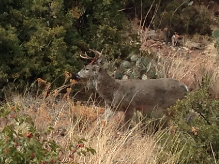

What's he doing on my trail? oh, wait, maybe I'm on HIS trail ...
Back at the Visitor Center:

I asked about hikes/trails that could tap into my inner-Ansel-Adams - streams, waterfalls, snow-covered-peaks. Both the Ranger and a hiker recommended the Window Trail, so that's next!
I drove down to the Chisos Basin Campground and started my hike:

Window Trail runs west-east:

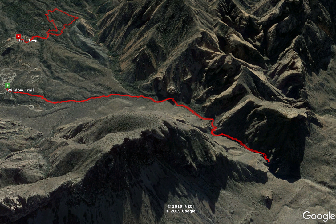
It is a fairly level trail, and I did 4.39 miles in 1 hour 52 minutes.
Wonderful views/rock formations:


After half-an-hour - looking forward:

and looking backward:

20 minutes later you hit running water (from a spring) - labeled on the map as "Spring":

Hey, I was able to rinse some of yesterday's mud/clay off my boots.
There is a nice deep pool:

And then you get to The Window:


I then got a little closer to the edge:

but it sure has a DANGEROUS look to going any farther!!
Cool view back at the car park:


This is Casa Grande, which dominates the whole Chisos Basin.
I went back to the Visitor Center and did the Window View Trail - 0.45 miles in 12 minutes:

A very nice paved trail (handicap accessible), which gives you a nice sense of the park:


Then, because it was only 4:40 (and I had more than 2 hours of daylight), I went on another hike. When I had mentioned Ansel Adams, a second Ranger jumped in and talked all about his "photos around the Park", including the Hoodoos up on the road going north from the Panther Junction Visitor Center. So I drove up there and parked:

and hiked west into the desert:


The desert is raw but very walkable:


and the hoodoos (rock formations) are pretty cool:


(I like the moon in the upper-left). 1.51 miles in 35 minutes.
Great view on my way back out of the Park:

Back in Terlingua at 6:30. Excellent cheeseburger for dinner, then night 2 of "Heavy Rescue: 401" on The Weather Channel - a GREAT show about towing companies rescuing jack-knifed tractor trailers and overturned tanker trucks on Hwy 401 just outside Toronto! Thank you God for all these Wonderful Adventures!
Today's Drive - 80 miles, 1 hour 48 min:

Driving Music:
Robbie Robertson - Robbie Robertson, 1987 first solo album

It has a real nice "wide open spaces" feel to it, with some hard-edged rock-and-roll grit.
Fleetwood Mac - Rumours, 1977

It won the Grammy (February 1978) for "Album of the Year".
No comments:
Post a Comment