I really had nothing planned except get up and drive to the East Rosebud Trailhead, and then hike. Well, ok, I wanted to buy 2 more Crunch bars (on sale at Walgreen's), so I mapped the Walgreen's in Billings. Google Maps had me take an earlier exit, and lo-and-behold I was suddenly driving RIGHT BY a National Monument - Pompeys Pillar National Monument:


Captain William Clark ("the Lewis & Clark Expedition") carved his name in the sandstone butte:


um, no big deal for me, but he also wrote in his journal:


the view was really nice, but I didn't see "emence herds of Buffalow, Elk, and wolves":
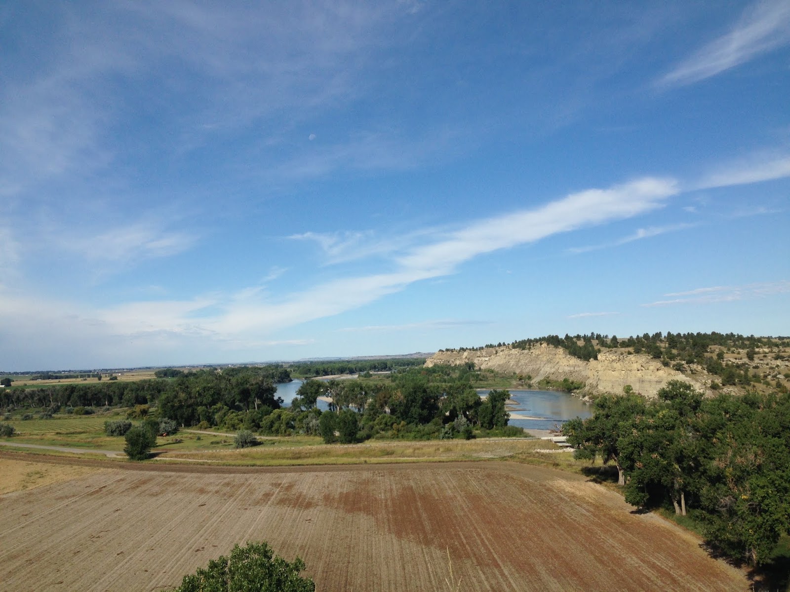


It is right alongside the Yellowstone River, which is right up there with the Snake River for "My Favorite River in the United States":


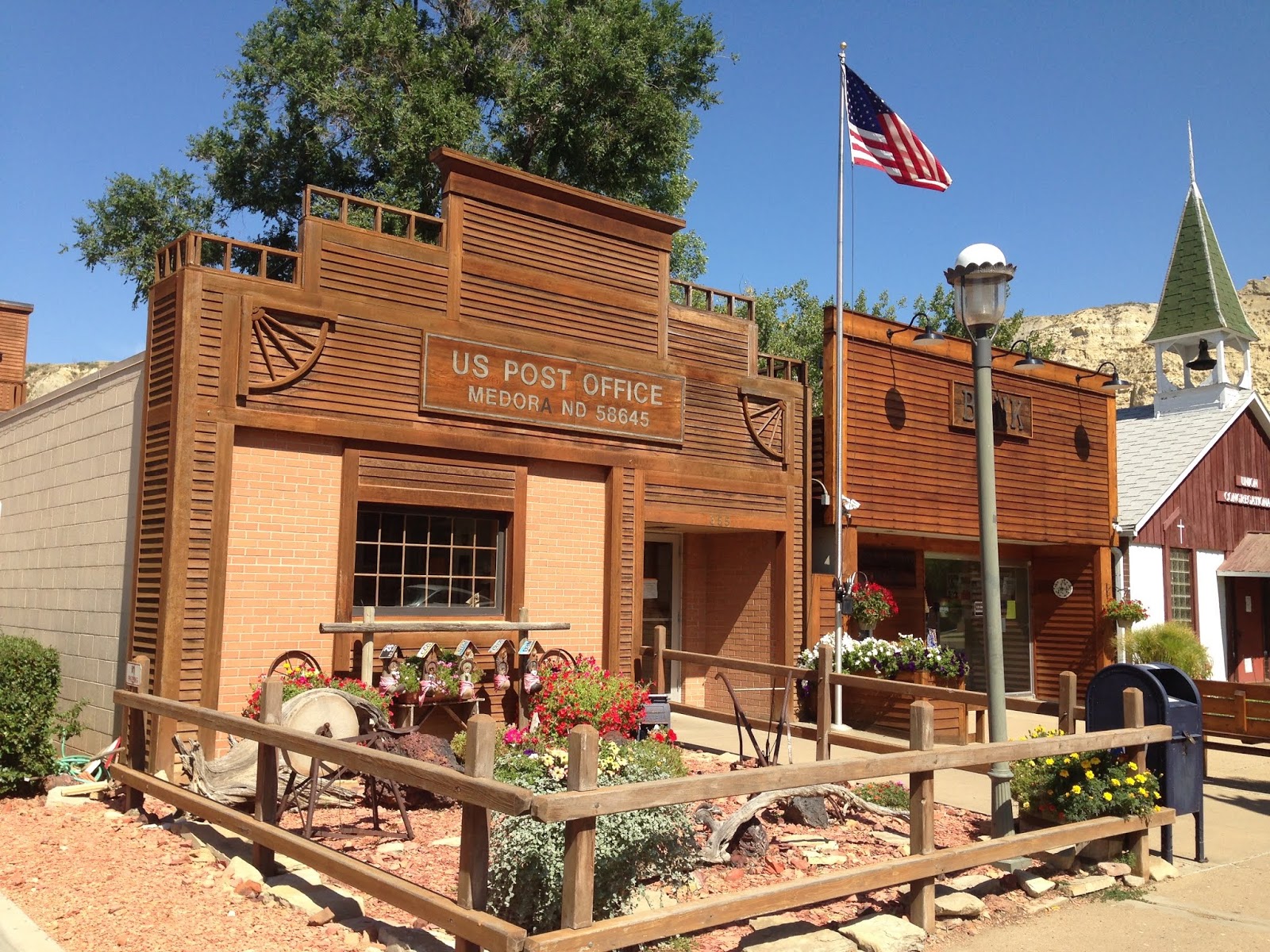
40 minutes later I was over in Billings, Montana. My "Walgreen's stop" actually turned into quite a list: Walgreen's, a bank for ones, gas, US Post Office, Subway for lunch, coffee for the road. Well, it turns out THEY ARE ALL AT FOUR CORNERS OF A SINGLE INTERSECTION:

Thank You God!!!
Kind of wide-open-flat in this part of the country:

But then I saw The Mountains - With Snow:

Beautiful views driving up to the trailhead:

and up at the Trailhead (East Rosebud Lake), there are a bunch of cabins/houses:

(maybe Wendy and I can stay here someday?)
It was 64℉ when I started hiking:


Yes, the views are BEAUTIFUL:

One hour in, looking ahead, toward the sun heading down in the west:

and looking back behind me, back down the valley:

3.5 miles in is Elk Lake:


from the top of Elk Lake, looking back as the sun behind me makes the mountains blaze:

Hiking Note: when you hike into the sun, ALWAYS LOOK BEHIND YOU - the sun will make it all Come Alive!
Hiking up the canyon:


to Rimrock Lake:

at the bottom of Rimrock Lake you cross a bridge:

and hike up the north side of the canyon:

The trail is a trade-off between back-and-forth switchbacks, and nice straight paths:

I got to Rainbow Lake just after 5 PM:


6 PM, looking back down at Rainbow Lake:

(This is a Long Hike!)
7:30 - The Mountains are ABLAZE:

and I set up camp 15 minutes later:


I was camping on the north side of Duggan Lake, with Impasse Falls at the west end:

I was "planning" on hiking 16 miles up to Fossil Lake, but 13.5 miles (uphill) is certainly enough for me today (and its a Perfect Camping Spot). Thank you God for these Beautiful Places, and for giving me the body that allows me to get out and explore!
driving Music for today I did another "R" album:
R.E.M. - Reckoning, 1984 second album

I then listened to a Country Station for about an hour, until I had had enough of that. I found The Mountain, 99.3, out of Red Lodge, Montana:

It sounded GREAT - high-energy 80s and 90s songs!
Which took me to the Trailhead!